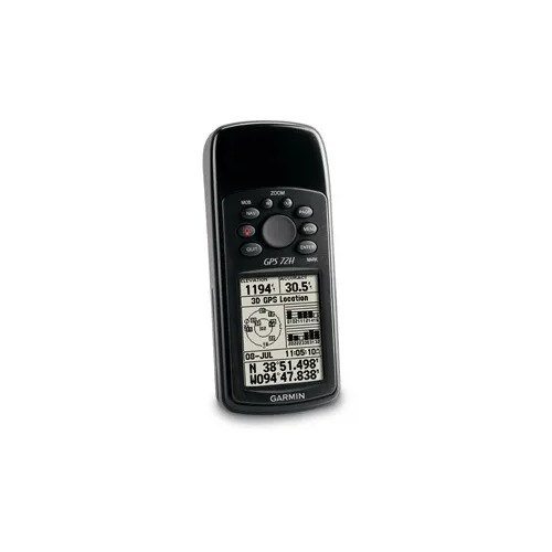
Make a splash with the GPS 12H handheld that floats. Simple yet robust, the lightweight handheld features high-sensitivity GPS that updates position and heading every second. Acquire Satellites Quickly Find your way effortlessly with the GPS 12H handheld’s high-sensitivity GPS receiver. GPS 12H acquires satellite signals quickly and tracks your location in challenging conditions, such as heavy tree cover or deep canyons. Use on Land or Water Don’t worry about losing this GPS device in the drink. The GPS 12H floats in water, and it’s water resistant(IPX7) to withstand the accidental dunk or splash in the lake. Whether on water or land, the GPS 12H can save up to 1,000 waypoints and 100 tracks so you can easily navigate back to them. It’s high-contrast monochrome display with built-in backlight makes it easy to read, regardless of the time of day. Store Important Data To transfer data to your device, GPS 12H easily connects to your computer via USB and serial. If you’re into boating, hunting or fishing, you can use the 12H handheld’s built-in celestial data, which includes sunrise/sunset times, estimated time of arrival and other calculations.
![GPSMAP-585-plus1[1]](https://synergyenayam.com/sitepad-data/uploads/2025/04/GPSMAP-585-plus11.png "GPSMAP-585-plus1[1]")
Find the perfect place for fishing thanks to the power of Garmin CHIRP technology Bright and clear WVGA color screen diagonal of 6 inches with vertical display mode, keypad and dedicated buttons. CHIRP sonar sends a steady beam of frequency ranging from low to high. CHIRP sonar creates sharper fish in the harbor and gives better separation objectives. Built CHIRP sonar standard power of 600 watts (RMS) and CHIRP sonar scanning Cleary give almost photographic representation of what is below your boat with detailed images of the object, structure and fish. Since it is compatible with powerful GPS, GLONASS and Beidou positioning system, you can easily record up to 12,000 precise points that will take you back to your favorite fishing spot. Includes free and intuitive software Quickdraw Contours for the current production of personalized definition of fishing charts. GPSMAP 585 Plus includes full support for NMEA0183 and RS422 communication interfaces for connection to sensors and accessories from other manufacturers. 2 standard slots for SD ™ card enables memory expansion to purchase additional maps, such as HD BlueChart® g2 or BlueChart g2 Vision® HD maps.
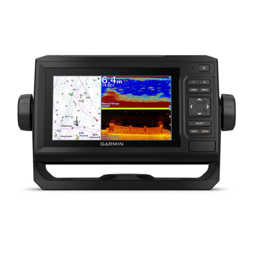
The sunlight-readable 6” chartplotter features a quick-release bail mount, and the transducer bundle adds Ultra High-Definition scanning sonar and CHIRP traditional sonar. See below your boat in incredible detail with optional transducer,
Navigate any waters with optional charts and maps,
Manage your marine experience from nearly anywhere and
Create your own maps on the fly and tailor them to fit your needs.
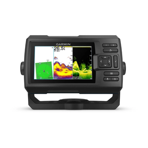
See fish and structure in maximum detail when you pick your display colour, your location and your sonar for your day on the water with the STRIKER Vivid 4cv fishfinder with transducer.
The sonar colour you pick says a lot about your fishing style.
Good thing there are 7 new vivid options.
Use the included transducer to get CHIRP traditional and ClearVü sonars.
Never lose a hot spot again. Use waypoint marking to find your way back.
- Multi language support : English, Simplified Chinese, Traditional Chinese, Japanese, Korean, Indonesia Bahasa, Malaysia Bahasa, Vietnamese, Burmese, Thai.
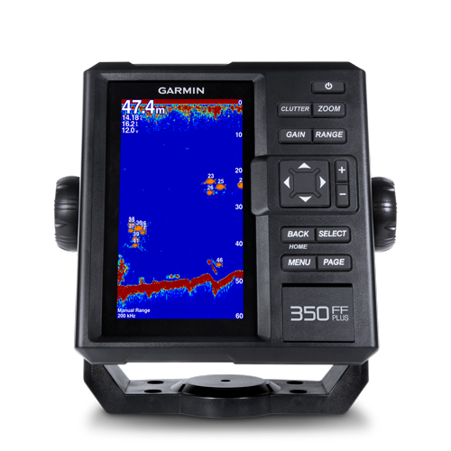
- Available in bigger and clearer 6-inch WVGA color, portrait mode display. Offers a keyed interface with dedicated buttons.
- Built-in 300 W (RMS) sonar power output and extra-sensitive Garmin HD-ID™ target tracking technology. Flexibility to support 50/77/200 kHz for shallow or deep water usage.
- Comes with built-in ClearVü scanning sonar. This high-frequency sonar gives a clearer picture of what’s below the boat by producing a photographic image with detailed representation of objects, structure and fish.
- Night color display modes is easy read while during dimming light condition to increase the navigating safety.
- Rugged, outdoor look complements your lifestyle. New connector and knobs of bail mount design. Able to withstand the harsh marine environment with excellent performance.
The all-new FF 350 Plus fish finder new product is available in bigger and clearer 6-inch portrait WVGA display. FF 350 Plus is offered with Asian multi language supports and developed the target for semi-commercial fishing market. Garmin FF 350 Plus is an all new design with reasonable price tag fish finder. FF 350 Plus gives you built-in Garmin traditional sonar and ClearVü scanning capability which shows crisp fish arches with clear target separation.
Clearest Scanning Sonar on the Water
Garmin ClearVü scanning sonar gives you a nearly photographic image down below your boat. Traditional Garmin HD-ID sonar and ClearVü scanning sonar are combined into 1 transducer.
Quick PAGE Sequence
Dedicated PAGE button to have a quick function switch. Press the “PAGE” button to let user can switch from frequently use feature one by one quickly. With holding the "PAGE" button user can edit their prefer 5 frequently use pages theirsleves.
Dedicated button for most common used function
Benefit for the professional fishermen like you, FF 350 Plus features with dedicated button on its right side for you to quickly adjust the setting you need for “Gain”, “Range”, Clutter and “Zoom” function.
Depth Data Graph
Provides instant value and history logs graph to understand submarine topograpgy and shows you the history of depth data graph at a glance.
Digital Zoom and Shift Zoom Supporting
Digital Zoom and Shift Zoom features let you control your owned display portion as what you prefer to shows in detailed.
Night Color Display Mode
Night Color Display mode let you configure your prefer display color no matter during day time or night time.
- Multi language support : English, Simplified Chinese, Traditional Chinese, Japanese, Korean, Indonesia Bahasa, Malaysia Bahasa, Vietnamese, Burmese, Thai.
- Available in bigger and clearer 6-inch WVGA color, portrait mode display. Offers a keyed interface with dedicated buttons.
- CHIRP sonar sends a continuous sweep of frequencies ranging from low to high. CHIRP sonar is able to create crisper fish arches with better target separation.
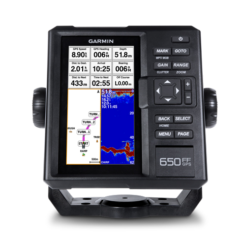
- Built-in 600 W (RMS) CHIRP traditional sonar and CHIRP ClearVü scanning sonar gives a clearer picture of what’s below the boat as a photographic image with representation of objects, structure and fish.
- Compatible with GPS, GLONASS and BeiDou powerful positioning systems what quick and easy to drop up to 12,000 accurate waypoints let you find your way back to your secret fishing hot spots.
- FF 650 GPS supports for typical NMEA0183 and RS422 communication within 3rd party sensors and accessories.
The all-new FF 650 GPS chart plotter / sonar combo is available in 6-inch display and keypad interface. FF 650 GPS is offered to support with Asian multi language and developed the target for semi-commercial fishing market. FF 650 GPS gives you built-in CHIRP traditional sonar and CHIRP ClearVü scanning sonar capabilities which shows crisp fish arches with excellent target separation and provides clear images of structure below the boat. Supporting GPS, GPS + GLONASS, GPS + BEIDOU 3 kind of powerful positioning modes.
The Power of Garmin CHIRP
The built-in sonar capabilities of FF 650 GPS includes CHIRP sonar, the most sophisticated sonar technology available for the fishing and boating public. CHIRP sonar provides amazingly clear target separation and definition because it puts even more energy onto the target than traditional sonar.
Clearest Scanning Sonar on the Water
Garmin CHIRP ClearVü scanning sonar gives you a nearly photographic image down below your boat. Traditional Garmin HD-ID™ sonar and ClearVü scanning sonar are combined into 1 transducer.
Compatible with GPS, GLONASS and BeiDou
With multi positioning modes supports to GPS, GLONASS and BeiDou three powerful systems. It is quick and easy to drop up to 12,000 accurate waypoints and find your wayback to your secret fishing hot spots. Huge capacity memory to help fishermen record danger spot(Mark) and the destination(Waypoint).
AIS Radar Support*
Show you the detailed AIS Radar view and AIS list at the same page. Move the cursor and review particular item on the radar view to see the detail information of highlighted vessel. Drop VRM/EBL and measure distance on the AIS Radar view window and to focus a AIS vessel through the AIS list to see the detail of it.
*The AIS radar support function is just software feature, and it must connect with external AIS device thru NMEA 0183
Quick PAGE Sequence
Dedicated PAGE button to have a quick features exchange. Press the “PAGE” button to let user can switch from frequently use feature one by one quickly. With holding the"PAGE" button user can edit their prefer 5 frequently use pages themselves.
Digital Zoom and Shift Zoom Supporting
Digital Zoom and Shift Zoom features let you control your owned display portion as what you prefer to shows in detailed.
Color Filter for Traditional Sonar Display
8 color levels let users can switch the toggle to turn ON/OFF the specific color on traditional sonar page with their owned preference to show the sonar display.
Depth Data Graph
Provides instant value and history logs graph to understand submarine topography and shows you the history of depth data graph at a glance.
Compass Page to Know COG and SOG at A Glance
Display speed and heading at one page shows to semi-commercial fishermen. They can rely on these information to judge whether the net is full or not while trawling and understand to align the direction of casting the net just at a glance.
GPX Waypoints Transfer
If you have waypoints, tracks or frequently used routes stored on another manufacturer’s GPS product - or on a Garmin handheld device - now it’s easier than ever to transfer those items to your new Garmin chartplotter, via industry-standard GPX software formatting. GPX is an open standard format for GPS data exchange across platforms and applications. With this easy-to-use interface technology, Garmin has taken “no waypoint left behind” to a whole new level of trade-up convenience.